Round Trip Distance: 6 miles
Difficulty: Easy
Elevation: 9422 - 9625 feet
Cellphone: 0-2 bars
Time: 3 hrs.
Trailhead: Ridge Trail #646
Fee: none
Attractions: Forest, wildlife, wildflowers
The Ridge trail is located south of Glade Park in the Fruita Division of the Grand Mesa National Forest. The Fruita Division of the Grand Mesa National Forest is about 27 miles due west of the main reservation on top of the Grand Mesa. One of the purposes of national forests is not only to preserve the trees but to manage and protect the water supplies. For the sole purpose of protecting the Town of Fruita's water supply the Fruita Division was added to the Grand Mesa National Forest reservation in 1906 by President Theodore Roosevelt.
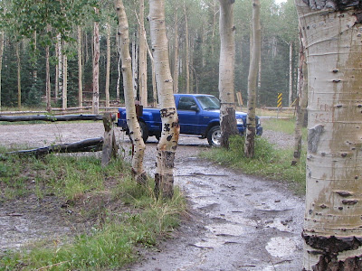
Access to the trailhead can be made with a 2-wheel drive vehicle on dry roads by turning south at the Glade Park Store on 16 1/2 Road. The pavement ends after 2.6 miles and you pass the Mud Springs Campground at 6.4 miles. Take the left fork at 7.7 miles and continue on JS Road which is unmarked unless they have replaced the sign. Follow JS Road for 1.7 miles and turn right on 18 Road which might also be unmarked. Continue past Enoch Lake at 1.8 miles and turn right into the trailhead parking area at 4 miles. The total distance from the Glade Park Store should come out to about 13.4 miles.
The Ridge trail follows a double track, Forest Road 401, all the way from 18 Road to Pinon Mesa. The Ridge trail can also be accessed from the Black Pine, Reservoir #1 and Hay Press trails. Forest Road 401 connects with 16 1/2 Road about 1 mile past the Hay Press trail. Snowmobiles and mountain bikes can take advantage of this trail to form a 16 mile loop that makes use of 16 1/2 Road, JS Road and 18 Road.
The Ridge trail has an elevation change of about 200 feet. All of the hills have very gradual slopes which give the trail a feel of being basically flat. The trail travels through large groves of aspen and spruce trees with a few small clearings along the way. There are a few places where you can leave the trail and walk over to the edge of the ridge to catch glimpses of the distant valleys and mountains but for the most part the trees limit your view to just what is immediately around you.
There are several places that hold onto the rain water and make some pretty good mud holes but there are good trails to get around them.
After about 2.3 miles the Ridge trail is joined by the Black Pine trail that comes up from the south and the Reservoir #1 trail that comes up from the north.
For this outing we turned around at the fence line just before reaching the Hay Press trail. At this point there was an afternoon thunderstorm approaching so high on a ridge didn't seem like the best place to be hanging out.
At one point we passed within about 20-30 feet of a large buck that was taking an afternoon siesta.
The buck really didn't seem to want to have to get up but after a few pictures he grew uneasy, I suppose, and moved off just a little further.
There were several does with their fawns that were a little further away. While they kept a watchful eye on us they didn't let it interfere with their browsing. We also saw a gaggle of about 6-8 turkeys but they didn't stick around for a photo.
By the time we finished the hike the thunderstorm had caught up with us. We had our rain gear with us so while it was a little tough for taking pictures it was still a nice time to be outdoors. The Fruita Division of the Grand Mesa National Forest is a close place to town to visit and escape the summer heat of the valley. My little truck only used about 4 gallons of gas to make the round trip from town. If you would like to see it for yourself then all you have to do is 'Take a hike'.


