


Round Trip Distance: 0.8 miles
Difficulty: Strenuous
Elevation: 5528 - 5869 feet
Cellphone: 0 bars
Time: 1 hr. 30 mins.
Trailhead: San Juan Co. Road MM 4
Fee: none
Attractions: cliff dwelling, petroglyphs
The Sparks Wall Ruin is located northwest of Monticello, Utah in the Indian Creek Recreation Unit of Bears Ears National Monument. The cliff dwelling, which sits high up on the side of the canyon, gets its name from a nearby climbing wall that is popular in the Indian Creek area. Petroglyphs can be found on a few of the boulders along the base of the talus slopes that lead up to the vertical cliffs.
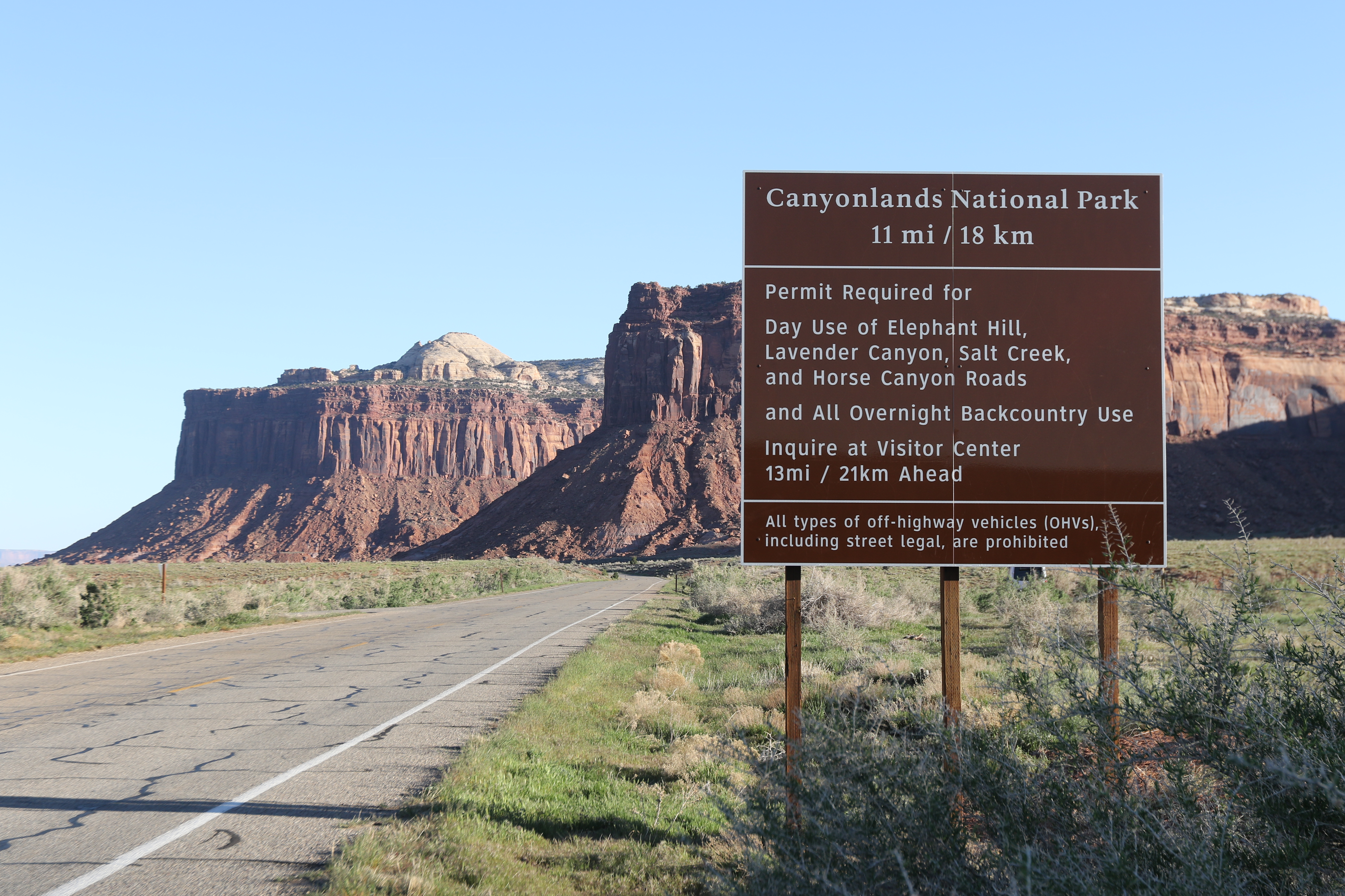
Swanks Wall is along San Juan County Road 107, aka the Bridger Jack Mesa Road. The turnoff for this road is on Highway 211, as you head to the Needles District of Canyonlands National Park, right at 20 miles from US Highway 191 between Moab and Monticello. There used to be a Beef Basin sign at the turnoff but it has since been replaced by the sign in this photo.

Right after turning off of Highway 211 there is a parking area and restroom on the left. From there the road drops down and crosses the creek. This photo was taken near the end of April while spring runoff was just ramping up. On this day the very swift moving water was up to the bumper of our Toyota Tundra. We saw smaller vehicles drive though where the water was in their grill which seemed a little nuts. Spring runoff is typically over just after the middle of June but even then you can expect at least a foot of water.

At the 4 mile point from Highway 211 there is a small parking area for Sparks Wall and a 4wd road that heads back toward the highway. This photo was taken looking back toward the highway in the direction which we had come.

The trailhead is at a primitive campsite that is right at a quarter mile down the 4wd road. From there you can spot the ruins high up on the cliff near the head of the short side canyon. It is a very steep climb up to the base of the cliffs followed by a somewhat exposed scrambling traverse to the ruins. Most of the ruins are easily viewable from below with or without a pair of binoculars.

This photo was taken with a zoom lens from the trailhead. There are more ruins on the right and some that stretch along the ledge to the left with still others that are clinging to the cliff on outcrops just below the ledge.

The trail up to the level of the ruins is very steep in places. The route is easy enough to follow but it is made up of a lot of loose talus and scree that make it more difficult to hike.

We made it up to the base of the perpendicular cliffs and part way to the ruins before giving it up and turning back. It ended up being more than a 70 year old man with questionable knees was willing to risk.

This photo was taken from a little hill that is across the canyon from the ruins. Here you can see how the ruins are stretched out both above and below the ledge.

Another photo taken part way up to the ruins. The ruins actually disappear completely from sight once you get about halfway up the side of the hill as you climb up to the ledge.

We found 3 different rock shelters around some of the larger boulders. We also marked a few places where there are some petroglyphs that are worth seeing. All of the petroglyphs aren't marked but they should be easy enough to find. They are all down low along the edge of the slopes as well as one that is on a boulder about 100 feet east of the 4wd road.

