


Round Trip Distance: 0.1 - 2 miles
Difficulty: Easy
Elevation: 4960 - 4968 feet
Cellphone: 0-3 bars
Time: 30 mins.
Trailhead: BLM 0931 MM 1
Fee: none
Attractions: pictographs, petroglyphs
The Counting Panel is part of a group of pictograph and petroglyph panels that are located along BLM Road 0931 in the Blue Valley Benches area southwest of Hanksville, Utah. The site overlooks the Birch Creek drainage that runs off of the north slopes of the Henry Mountains. The main panel of pictographs includes long rows of what look like tally marks which are probably what inspired the name 'Counting Panel'.
The most straightforward route to describe begins in Hanksville by turning south on 100 East and following what becomes CR-95, a 2wd dirt road, for 6.1 miles. At this point turn right toward Lost Spring on BLM 0092, the Bert Avery Road, and measure another 8.7 miles. You never know how you will find the Bert Avery Road. In dry weather 2wd vehicles should do fine but there are several places that get pretty muddy after a storm and some that tend to wash out and become impassable. It's always best to plan your travel when it has been dry for multiple days to avoid being disappointed.

Near the 8.5 mile point from CR-95 the road climbs a short dugout that takes it up onto the Blue Valley Benches. At the 8.7 mile point turn left onto BLM 0931.

BLM 0931 crosses a few rough outcrops of slickrock but they don't require a high clearance vehicle. If in doubt it is an easy 1 mile hike to where a short spur branches off on the right that leads to the panels after another 100 yards or so.

The rock art is all scattered along a short bench. This photo is marked with some of the most prevalent panels.

A few petroglyphs and faint pictographs can be found all the way around on the left side of the bench. The pictographs include a few very faint red carrot men.
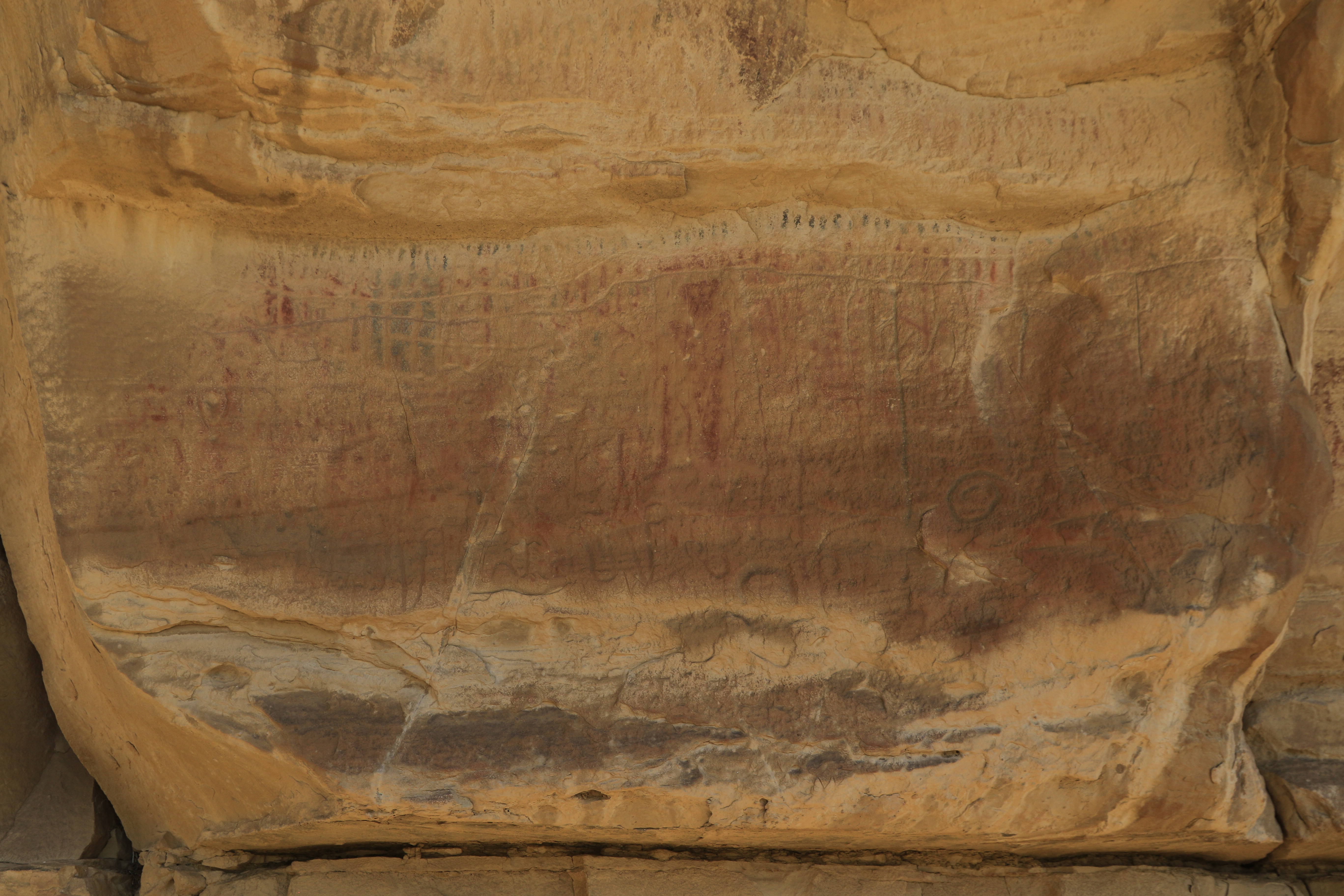
This is the main part of the Counting Panel.
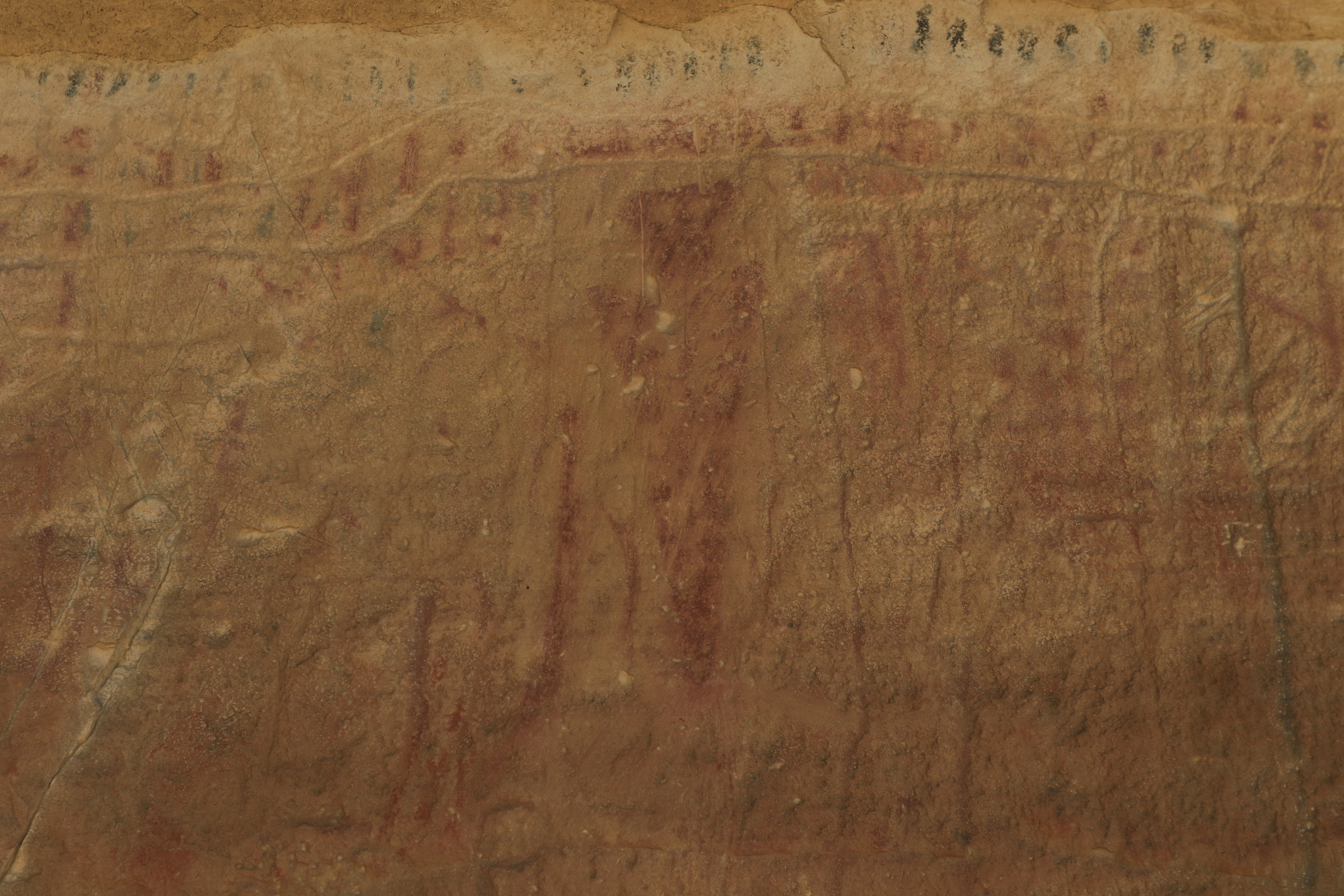
A single Barrier Canyon Style image dominates the middle of the panel while along the top are rows of the aforementioned red and black tally marks. It is difficult to discern the faint marks to the left and right of the central figure.

There are 2 more panels of tally marks further to the right of the main panel.

Various petroglyphs can be found as you explore the bench even further to the right.
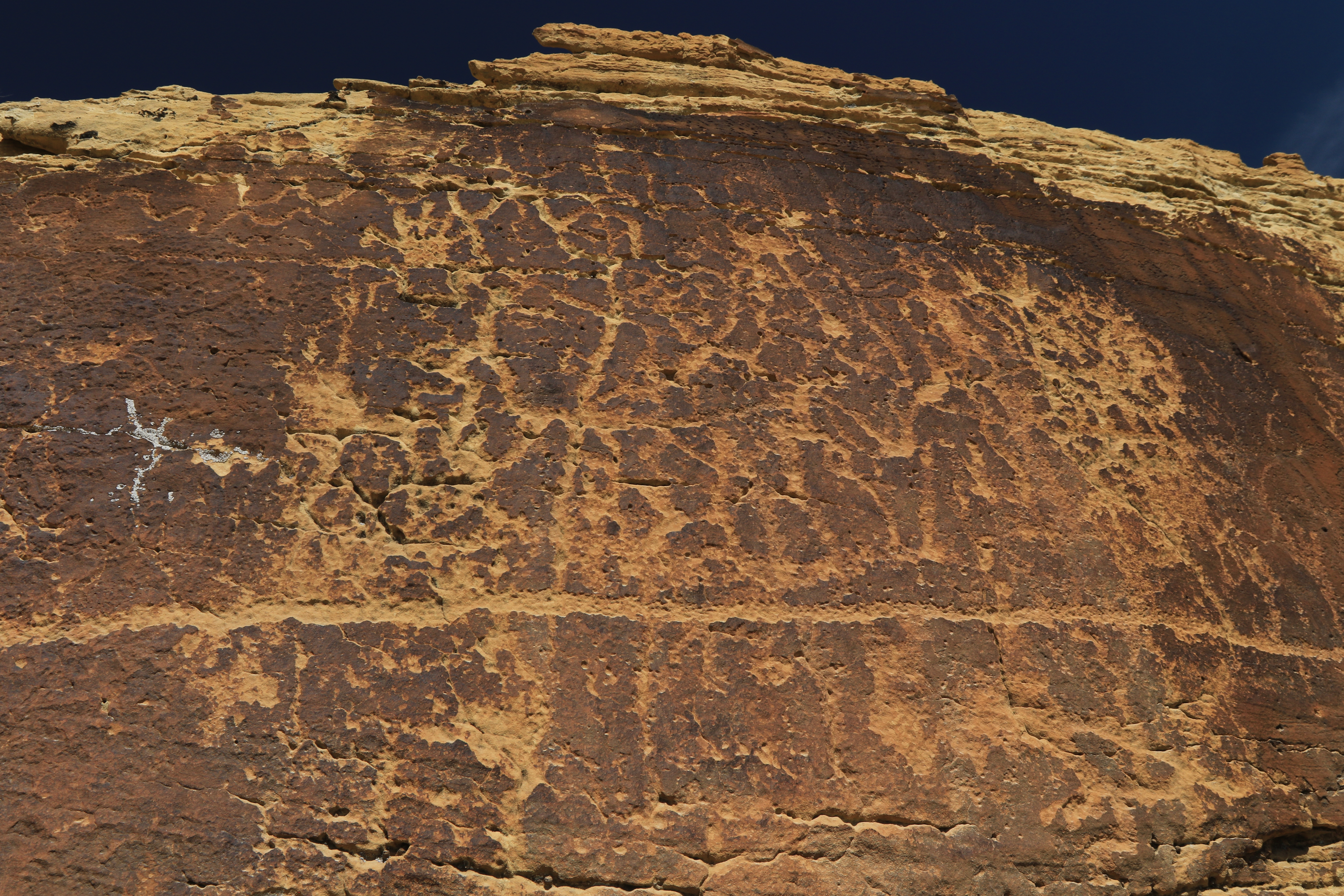
The last large panel of petroglyphs appears to have been a map of sorts.

