


Round Trip Distance: 0.5 - 2.0 miles
Difficulty: Easy
Elevation: 4673 - 4965 feet
Cellphone: 0-3 bars
Time: 30 mins.
Trailhead: East Creek
Fee: none
Attractions: Petroglyphs, rock shelters
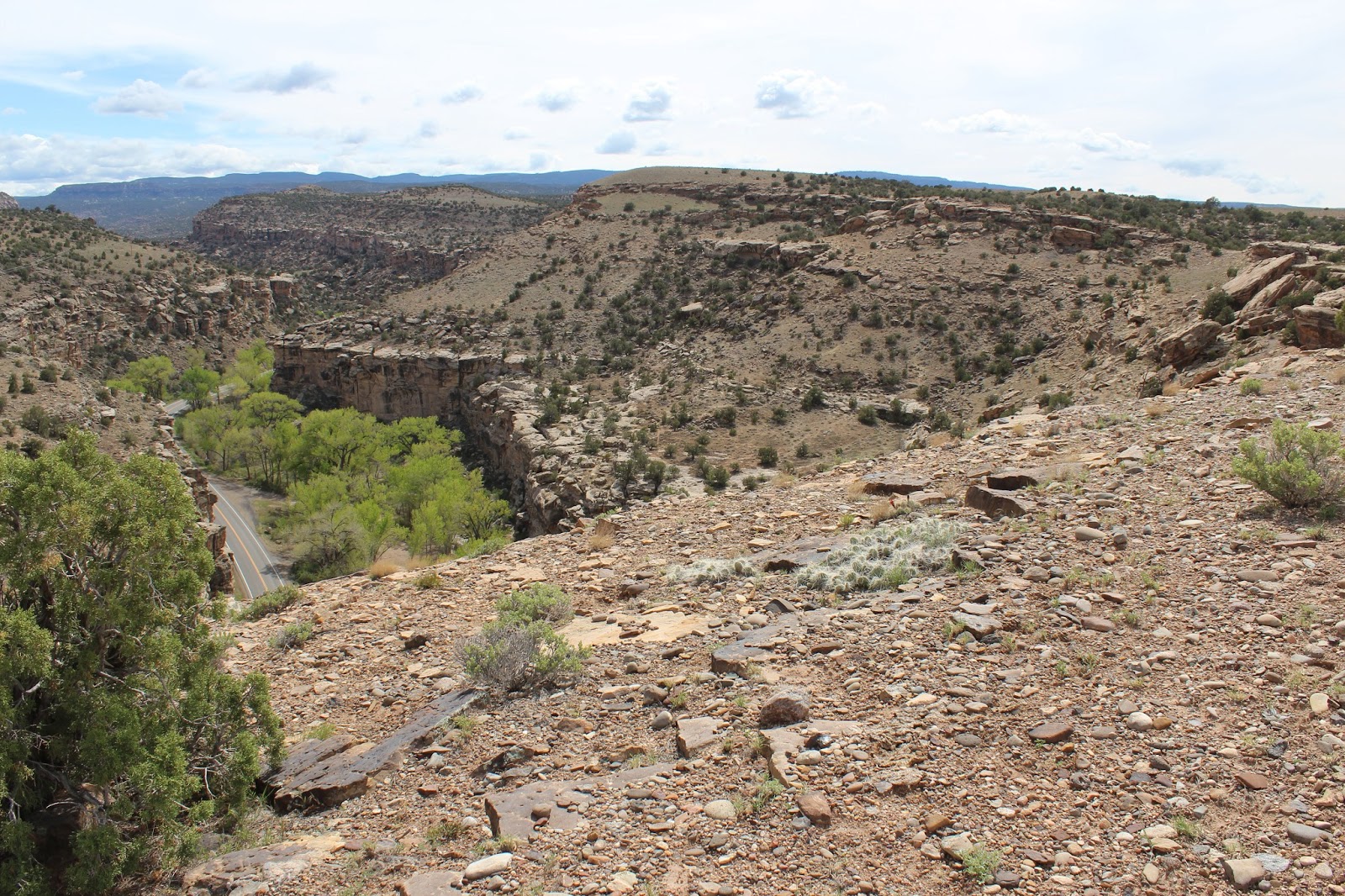
The East Creek petroglyphs are located near the eastern mouth of Unaweep Canyon on the cliffs above East Creek. Unaweep is a unique canyon where you have to specify which mouth of the canyon you are referring to. The canyon has a slight rise called the Unaweep Divide where East Creek flows toward one mouth and West Creek flows toward the other which I suppose makes the divide the head of the canyon. The cliffs above East Creek show signs of habitation from very ancient times and unfortunately up to very recent times.

The trailhead is at a small pullout just before the bridge where East Creek crosses beneath Highway 141 that runs between Whitewater and Gateway, Colorado. This location is just a few miles outside of Whitewater. It is at this point that the 140 mile long Tabeguache trail crosses the highway and Unaweep Canyon.

There are 3 main panels of petroglyphs on the face of the cliffs above the highway. If all a person is interested in is seeing the petroglyphs and nothing else they can do so by hiking less than a half mile round trip. The area also has several rock shelters that may also be of interest for those that would like to hike a little more. Parts of the trail are very primitive and require scrambling around boulders and the sandstone cliffs.

The largest panel of petroglyphs is on the cliff in almost a straight line above the trailhead if you line up the lower section of the trail from the gate to the top of the cliff. You can climb the hill directly to that point and then search out the remainder of the area for the other panels or you can do what we usually do which is to hike up the trail until it begins turning left and paralleling the cliff and then pick out a route to the right and climb the hill toward the mouth of the canyon. From that point we work our way back along the cliff until we get to the same panel of rock art.

After viewing the first panel of petroglyphs work your way along the face of the cliff heading west studying the rock as you go. Some petroglyphs are small and faded and are easy to miss.

These petroglyphs are on a surface that has a very dark patina and are pretty easy to spot.

Continue on around the cliff heading west and you should be able to find one or two more clusters of images as well as a few solitary ones.

As you round the cliff you will eventually find yourself near the top of the ridge where you can continue to the next area by following the Tabeguache trail for a short distance. Watch for an obvious trail that departs to the left heading toward another area of cliffs and boulders.

There are several rock shelters throughout this area. Some are very obvious and easy to find but others are well camouflaged. Near the last turnoff from the Tabeguache trail and across the shallow wash from the trail toward the cliff is a huge slab of rock that has rocks stuffed into some of the gaps beneath it. The rocks have been there a very long time as you can tell from the lichens and the dirt around them. Be sure to not disturb the area or any of the rocks. It is illegal to disturb or vandalise any archaeological site or to remove any items. Unfortunately many of the rock shelters not only in this area but others around the Gunnison Bluffs and further along the Tabeguache trail have been used by homeless people recently. Judging from refuse piles left at some sites they appear to have also been used back to the time the Utes were expelled from the area.

There are a few more sites further up the canyon in various places. None of them appear to have any petroglyphs but we didn't do an exhaustive search.

One particular site has rubble piles from at least 4 different walls that may have made up either 3 connected rooms or 2 separate buildings. The room furthest west along the cliff had uncut juniper posts buried in the ground. The fact that the posts show no signs of saw marks might be significant.
There are several more sites to the west for those interested in further exploration of the area. We picked a spot where it was relatively easy to climb up to the rim and continued until we reached an easy to hike draw that we used to get back to the Tabeguache trail and from there back to the trailhead.

Archaeological sites in the area including the Uncompahgre Plateau and the surrounding river valleys number into the thousands and date from Archaic (7000 B.C. - 400 A.D.) to the more recent Ute period. It is always interesting to contemplate what it may have been like to live in ancient times. The homeless people that have lived at some of these sites in recent years cannot be compared to those times at all. We found a diary at one location above the Gunnison River that mentioned they were going to go into town that day and pick up their food stamps and run errands. The area is still worth exploring and it does have several petroglyphs that resemble those of another place we have visited that is more than 100 miles away. If you would like to see it for yourself then all you have to do is 'Take a hike'.