Round Trip Distance: 0.4 miles
Difficulty: Moderate
Elevation: 744 - 819 feet
Cellphone: 0-3 bars
Time: 1 hr.
Trailhead: 33.22195, -112.77384
Fee: none
Attractions: petroglyphs
We have identified 4 petroglyph sites along the north end of the Enterprise Road near the Gillespie Dam north of Gila Bend, Arizona. This post is for sites II & III which are adjacent to each other at the top of a bluff overlooking the Enterprise Road. The petroglyphs were created on the basalt boulders that were probably deposited by an eruption of the nearby Gillespie Volcano.
The Enterprise Road is at the west end of the Gillespie Dam Bridge. For turn-by-turn directions you can enter 33.22195, -112.77384 into your driving app. Short of that drive north from Gila Bend on Old Highway 80 for about 22.6 miles and after crossing the bridge turn left onto the Enterprise Road.
Follow the Enterprise Road for only about a quarter mile and turn right. There are 2 places where you can turn right. The second turn is the more direct route. The first 3 sites are on the bluff a short distance away. After turning off of the Enterprise Road the route gets a little sandy so 2WD vehicles might want to park in the area of the second turnoff and walk the remaining quarter of a mile to what we marked as the trailhead. This is the same trailhead that we used for the first Enterprise Road site. There is an alternate trailhead a little further down where the hill isn't quite as steep but you might miss some petroglyphs going that route.
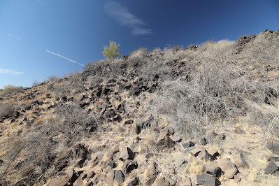
From the area of the trailhead that we marked begin scrambling up the hill by whatever route looks best. You might want to keep an eye out for snakes while you are at it. We saw one snake hole under a boulder that actually had a petroglyph of a snake on it as though as a warning.
Petroglyphs begin appearing before you get much past halfway up the hill. At least along the route that we took. Of course we took the route that we took because we could see petroglyphs on up above us.
There are a few faint petroglyphs that are hard to photograph but many of them show up quite well from the right angle.
It is a little time consuming scrambling around the boulders for closeup photos but it is also pretty fun for the most part.
This is one of those sites where there are so many petroglyphs that you get led off into one direction taking photos and forget to go back for the others that were in a different direction.
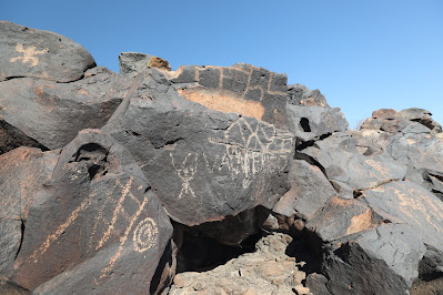
Pretty much every rock surface in this photo has an image on it.
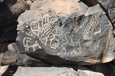
Sheep, snake, corn, and a nice geometric design.
Here is a large boulder with images all the way around it.
Densely packed designs.
Here are 10 or so snakes grouped together here that maybe implies a den.
A little to the south is another site that we designated as Site III. It doesn't have nearly as many petroglyphs but what it does have are interesting.
Bisected concentric circles with a few rays and a lobe with 3 squares. Don't know what it represents but it is interesting none the less.
The images also go all the way up to the very top of the hill at Site III.
We probably should have separated sites II & III into separate posts so we could show more of the images. Even after culling a large number of them the slideshow came out pretty long. We also wondered about accessing all of these sites from the top of the mesa from a road that leads up there. It might be easier although images lower on the hill would probably get missed. There are a lot of good petroglyphs to see here so we thought that it warranted 4 stars. If you would like to see them for yourself then all you have to do is 'Take a hike'.


