Round Trip Distance: 1.3 miles
Difficulty: Easy
Elevation: 2974 - 3127 feet
Cellphone: 0 bars
Time: 1 hr.
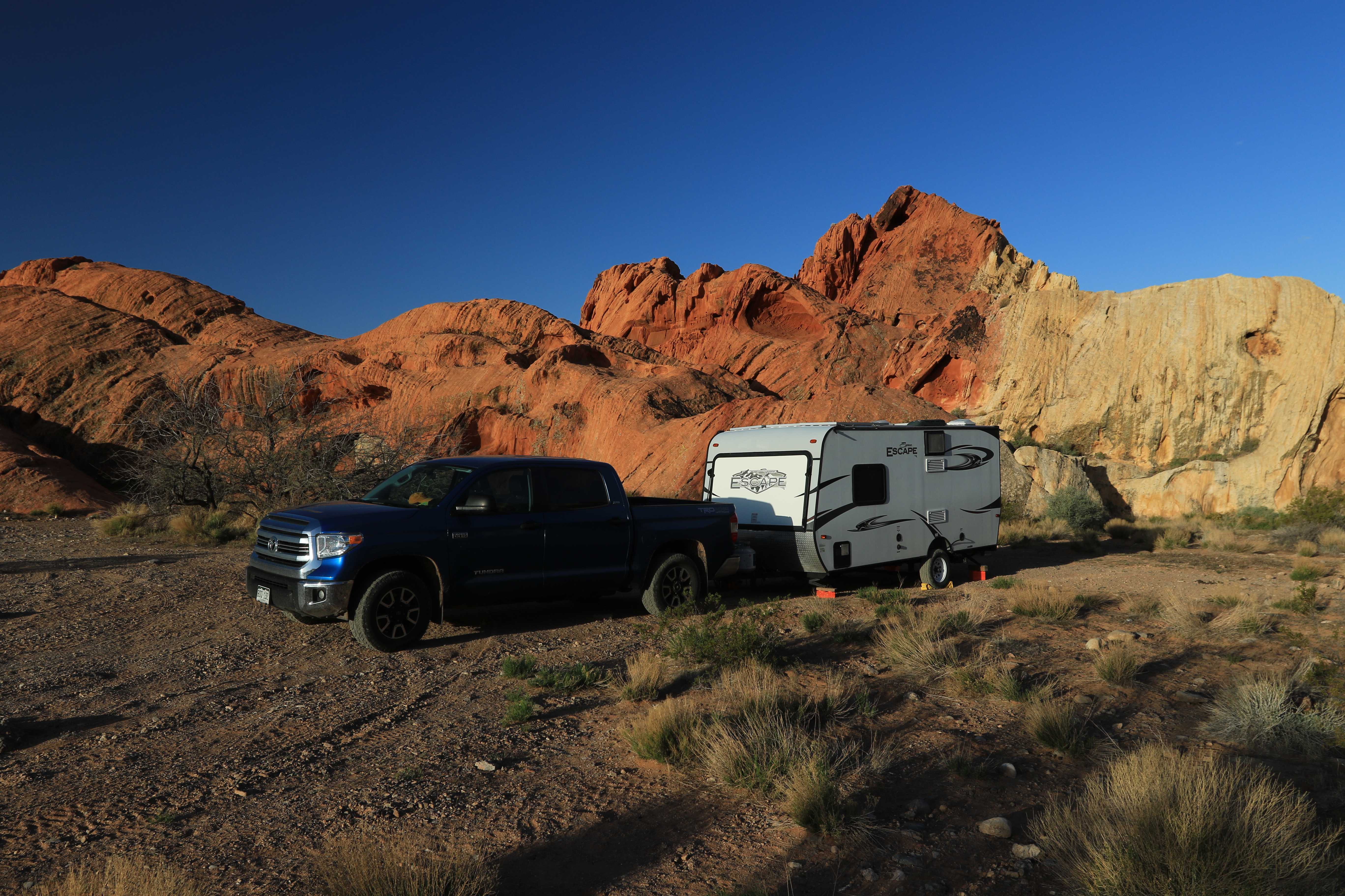
Trailhead: Whitney Pocket
Fee: none
Attractions: petroglyphs, CCC cistern/camp
Whitney Pocket is located in the Gold Butte National Monument near Mesquite, Nevada. This post is for a loop that can be made around one of the more prominent sandstone outcrops that rises scenically out of the desert floor like ships in the desert. Enroute there are a couple of places where petroglyphs can be seen as well as a cistern that was built by the Civilian Conservation Corp (CCC).

From Mesquite travel west on Nevada 170, the South Riverside Road, for about 9 miles and turn left onto the Gold Butte Road. Continue on this very memorable road of broken pavement for 21.2 miles to Whitney Pocket where the pavement ends. Due to the 20 miles of broken pavement the vehicle of choice would be something like an ATV or side-by-side. For turn-by-turn directions you can enter 'Whitney Pocket' into your driving app.

For this post we followed the 4wd road that loops around the north side of the main rocky outcrop.

At the start of the 4wd road you can look high up on top of the cliffs and spot some graffiti and petroglyphs.

The largest image is a big shield that has been used for target practice. To the far right of that is a very nice image of a turtle as well as a spiral and a few other images. (Climbing up for a closer photo was more than we cared to under go on this trip.)

There is one spot as the road continues around the north side of the outcrop that requires a high clearance 4wd that preferably has a short wheelbase. We cleared it in our Tundra but not knowing what else lied ahead we backed up over it again, parked, and set out on foot. There is at least one old rock shelter and a neat little arch that is easy to miss along the way.

There are more petroglyphs across a shallow wash on the left side of the road as it starts around the east side of the outcrop. We put a big red circle where they are on the cliff but a keen eye can pick them out from the road. This is right where the road enters the large open camping area.

The images are a little hard to see without climbing up on top of them. We settled for standing on a large rock out in front but this was the best we could do.

On the south side of the outcrop there is a pretty cool cistern that is tucked away in a short slot canyon that was built by the CCC. The dam is several feet thick and has steps on both sides.

Directly across the road from the cistern there is another outcrop of sandstone that has various ruins that are left over from the CCC camp. This little alcove has a natural vent hole in the roof. In the wall that is still standing you can see the air intake. A little further down the cliff is another cubby hole that may have served as an oven.