Round Trip Distance: 0.3 miles
Difficulty: Easy
Elevation: 1432 - 1482 feet
Cellphone: 0-3 bars
Time: 30 mins.
Trailhead: Saddle Mountain BLM Petroglyphs
Fee: none
Attractions: petroglyphs
The Saddle Mountain Petroglyphs are on BLM land a little southwest of Tonopah, Arizona. There are two groups of petroglyphs at Saddle Mountain for which we have coordinates. This post is for the main site to the west.

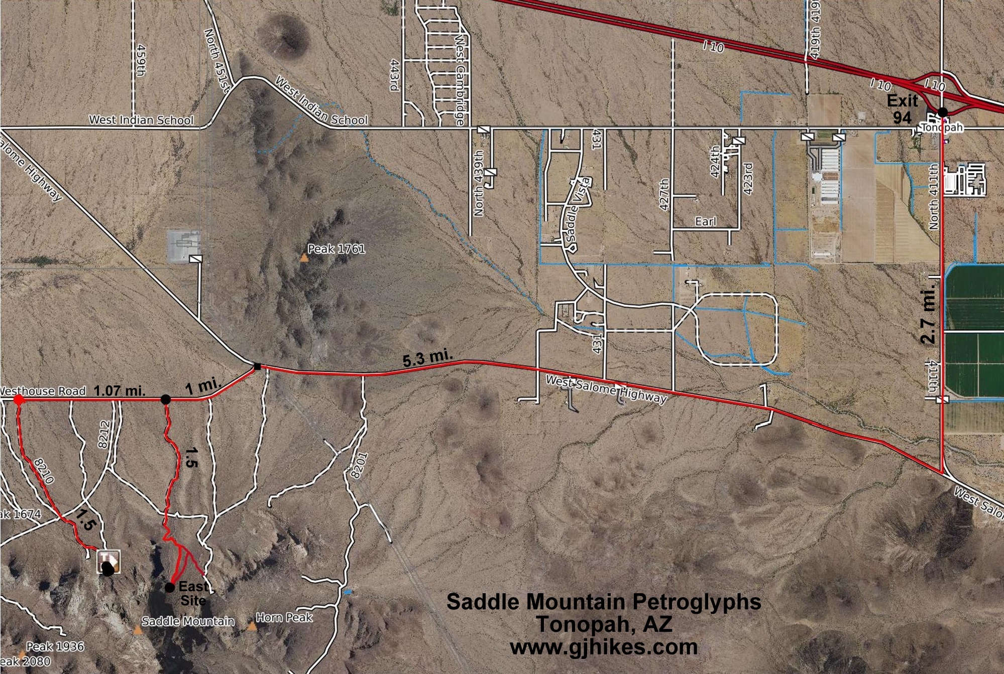
To get there, take I-10 Exit 94, and drive south on North 411th for 2.7 miles, then right onto the West Salome Highway for another 5.3 miles. At that point turn left onto the West Courthouse Road for 2 miles, then left onto BLM 8210 for 1.5 miles to the trailhead. The roads are all paved until you turn off onto 8210 which is normally driveable by most highway vehicles until you get closer to the trailhead where it becomes a little rougher.

For turn-by-turn directions you can enter 'Saddle Mountain BLM Petroglyphs' into your driving app. Once you arrive you will find a sign that reminds visitors to respect the past and help preserve the petroglyphs.

After parking it is a matter of searching around on the boulders and rocks for petroglyphs. All that we found were on the lower portion of the hill.

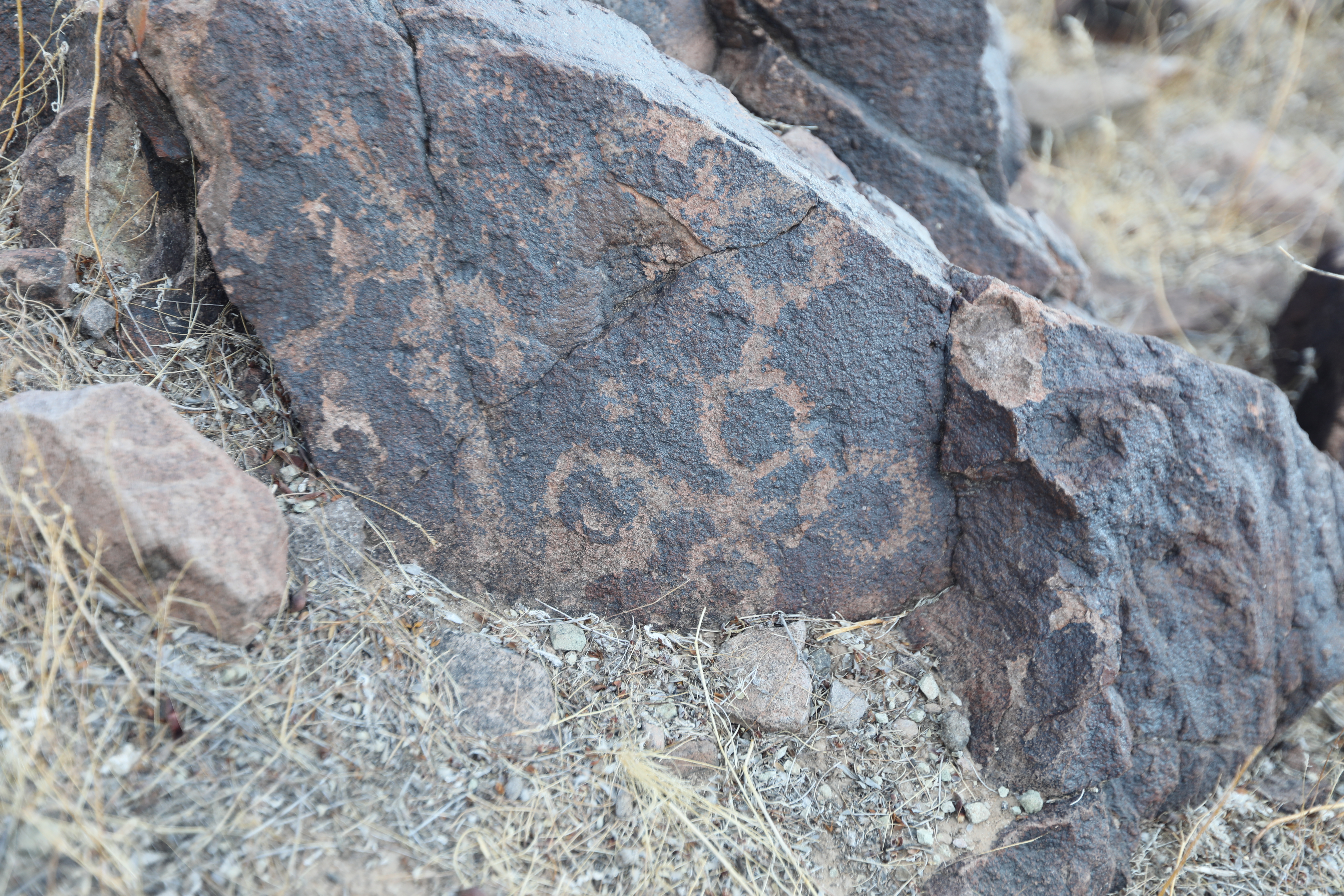
This is the largest panel that we found. Note the complete lack of any anthropomorphic or zoomorphic images.

The entire site seems to have only geometric designs other than maybe a couple of snakes (if that is what they are).

Nothing but circular shapes on this rock.

This image is hidden beneath a palo verde tree.
Interconnected circles and some other shapes.

Here is one that is a little different from the others but still an abstract.

There are two spots where it looks like there may have been some sort of structure at one time.