Round Trip Distance: 2.2 miles
Difficulty: Strenuous
Elevation: 7920 - 8430 feet
Cellphone: 0-4 bars
Time: 1 hr. 30 mins.
Trailhead: Point Lookout in Morfield Campground
Fee: $20/vehicle (May 1 to October 31) $15/vehicle otherwise
Attractions: Historic trail, scenic overlook
The Point Lookout trail is located in Mesa Verde National Park near Cortez, Colorado. The prominent point towers high above the entrance to the park and gives its name to the light colored sandstone, the Point Lookout formation, that caps the cliffs along the north side of the park. Point Lookout was purportedly used by the U.S. Cavalry as a signaling point. It has undoubtedly also been used for that purpose by most all of the early inhabitant of the area.
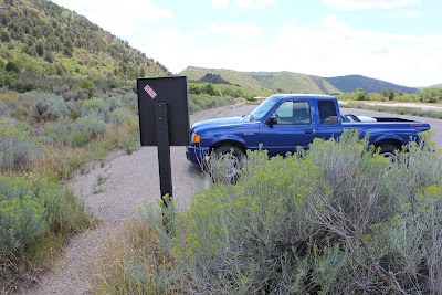
The trailhead for the Point Lookout trail is located near the amphitheater in the Mesa Verde Morfield campground. The sign at the trailhead gives the elevation gain at 400 feet but according to GPS readings it appears to be every bit of 500 feet. Pretty much all of the change in elevation is packed into a half mile long series of switchbacks that lead up the south flank of the mountain.
The trail starts out cutting across the sagebrush flats toward the saddle between Lone Cone, the prominent hill on the left, and Point Lookout on the right. Deer can be seen browsing in the area during the early morning and evening hours. They tend to bed down in the oak brush during the daytime.
As the trail enters the oak brush it begins its steady climb up the mountain.
Rocks and logs were used to stabilize the trail and reinforce the edges. The trail sheds water quickly after a good rain. Plant fossils can be seen in may of the rocks although there aren't any as pretty as well formed leaves.
The rate of ascent is easy to gauge by comparing your height to the surrounding mountains. It doesn't take long before you can peer over the tops of some of them. Looking past the north side of Lone Cone, Ute Mountain can be seen in the distant background. The mountain is said to be considered sacred by the Indians of the Ute Mountain Tribe.
At times the switchbacks give way to longer stretches of trail with a more gradual slope that afford an opportunity to rest up a bit.
The views open up in all directions from the top of the ridge.
The next half mile of hiking is like a stroll in the park as the trail makes its way to the lookout point. The middle of the ridge narrows down to less than 30 feet wide. The sign at the trailhead warns parents that the edges are steep and there is no fence to keep children from falling. Even with the precipitous cliffs there is enough vegetation on both sides of the trail that you shouldn't feel uncomfortable if you are bothered by heights. If you walk over to the edge, well then that is another story.
The trail passes through an old rock shelter near the end of the ridge. Shelters like these are common on many high ridges in Colorado such as one used by the Utes in Canyon Pintado which was also a lookout point.
One very interesting characteristic of the Point Lookout is all of the initials inscribed on the rocks. Some of them include dates but they only used the last two digits of the year so there is no way to know what century they were inferring.
The Point Lookout trail is one of 3 trails at the Morfield Campground in Mesa Verde. The other 2 being the Knife Edge trail and the Prater Ridge trail. This is a great trail for visitors to the park that are missing their daily workout at the gym. After a quick trip up either Point Lookout or Prater Ridge they should feel very satisfied with the results. Camping spots are generally always available except maybe the ones with electrical hookups. The tent campsites currently go for about $26/night which includes free showers. There is public internet access at the General Store that is suitable for checking email. The store has some food items with a pretty good assortment of liquor. A gas station, laundromat and a cafe that serves an all-you-can-eat pancake breakfast are other services that help you pick the level of 'roughing it' that best suites your fancy. If you would like to see it for yourself then all you have to do is 'Take a hike'.


