


Round Trip Distance: 0.8 miles
Difficulty: Easy
Elevation: 6396 - 6423 feet
Cellphone: 0 bars
Time: 45 mins.
Trailhead: Ruin Park Road mm 3.3
Fee: none
Attractions: Ancestral puebloan ruins
Ruin Park Village is located in the Beef Basin area just south of the Needles District of Canyonlands National Park and 67 miles northwest of Monticello, Utah. The area is divided by natural features into sections known as House Park, Middle Park, Ruin Park, Beef Basin and several canyons that are collectively simply referred to as Beef Basin. As its name implies this once well known, but now obscure, pueblo can be found on a low ridge, in Ruin Park.

After descending through House Park and coming to this signed junction, 34.8 miles from Highway 211, reset your odometer to zero and take the right fork toward Ruin Park.

Going to the right the road travels slightly uphill through Middle Park and over a short divide into Ruin Park. At one time there was a road that led right up to Ruin Park Village. Presently that now abandoned route is now barely visible on satellite views. Before heading to Beef Basin we had created a GPX track that followed the old road and began by parking near the 3.3 mile point of the Ruin Park Road to search for the old road. Without a trailhead or pullout to take advantage of we pulled off into the ditch out of the way so others could easily pass.

The old road is almost completely reclaimed by nature but happily the vegetation is sparse and short keeping the hike across the flats to the ruins easy.

The sign was in 2 pieces when we arrived so we put it back together to take its photo. A strong wind will probably blow the top of the sign once again. For those that might be wondering the distance we hiked up to this point was 0.3 miles. Another tenth of a mile occured hiking around the ruins and over to the kiva and back.

The higher remaining walls are to the right of the sign.

To the left of the sign a chain of ruins can be seen stretching along the ridge.
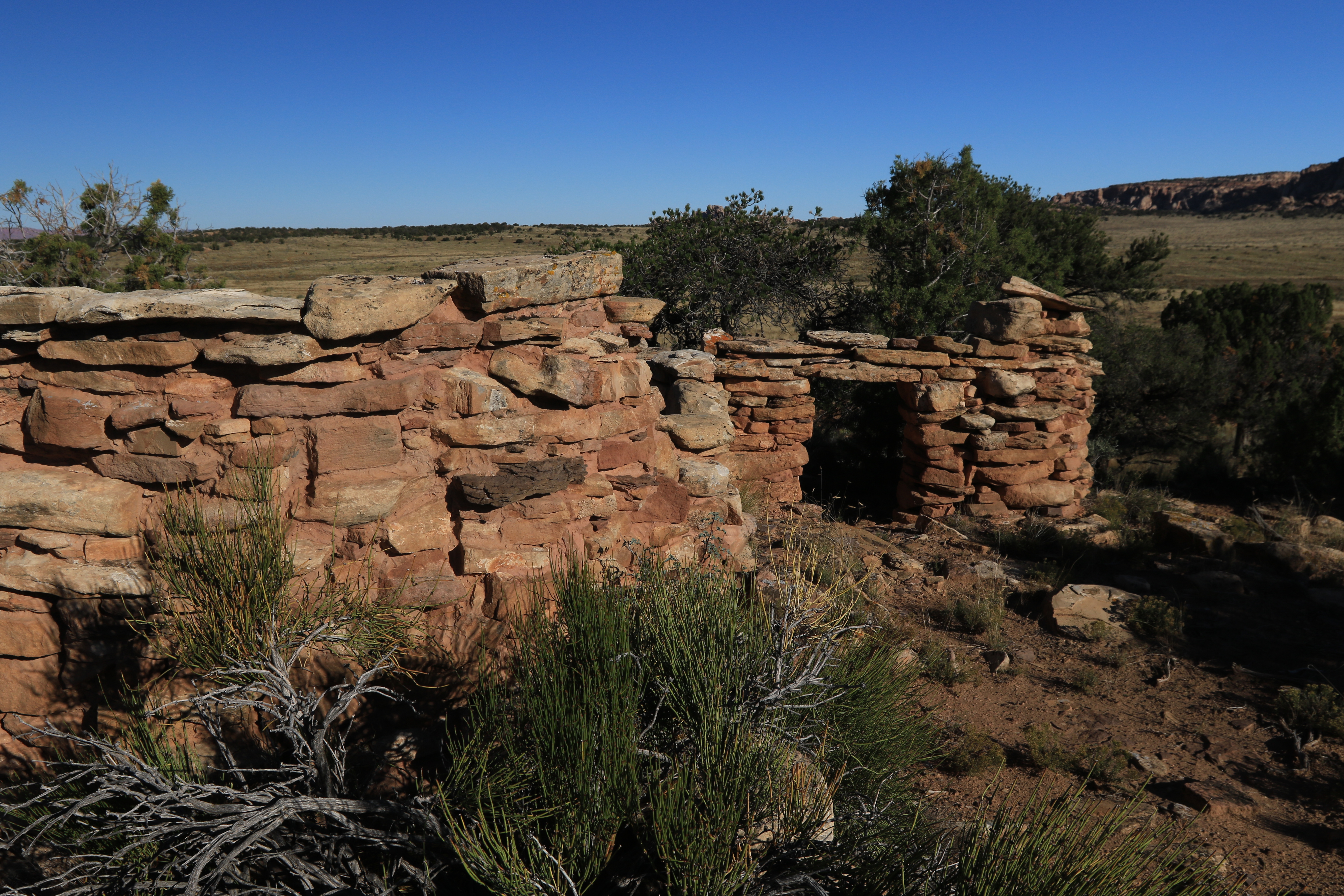
Judging from the size of the rubble piles most of the rooms may have been a single story high.

The probable kiva that is mentioned on the sign is about 100 feet to the south. A faint ring of rocks marks the site.

Shards of pottery include monochrome, corrugated and pieces from rounded necks or handles. Please remember that it is both illegal and unethical to remove any objects or do any digging or anything else to disturb the ruins.


An alternative to parking where we began would be to continue up the Ruin Park Road for another few hundred yards until straight across from the ruins which a keen eye can then pick out just inside of the treeline. The hike would be a little longer from that point but you would have no doubt where the ruins are located. We haven't seen Ruin Park Village on any maps but discovered it by zooming in on Google Maps satellite view and scanning the area. We were pleased once we reached the site to find the sign that gave us its official name. If you would like to see it for yourself then all you have to do is 'Take a hike'.