


Round Trip Distance: 0.5 miles
Difficulty: Easy
Elevation: 4858 - 4956 feet
Cellphone: 0-3 bars
Time: 1 hr.
Trailhead: Emery County Rd. 125
Fee: none
Attractions: petroglyphs, ruins
Located near the confluence of Grassy Trail Creek and the Price River are quite a few nice Fremont petroglyphs on various boulders at the base of a hill. On top of the hill there are several ruins that include a large circular wall that may have served as an above ground open top kiva or other ceremonial circle. Ruins that are lower down on the hill appear to have been dwellings similar to pithouses and pueblos.

To get there drive either 19.2 miles south of Wellington on US-191 or 33.4 miles north of I-70 Exit 157, just west of Green River. The turnoff is on the west side of US-191 across from a rest stop where there are restrooms. The road that heads west is County Road 125 but at present there isn't a sign letting you know that's what it is.

CR 125 starts out suitable for passenger vehicles.

At the 2.6 mile point it crosses the railroad tracks and stays right at the 3 mile point.

There is a left turn at the 3.9 mile point where the route begins a 3/4 mile gradual descent from the mesa to the level of Grassy Trail Creek and the Price River. From this point on a 4wd vehicle with moderate clearance would be more suitable to aid with the climb back up to the mesa and a few areas of deep sand at the bottom. If you were to park here you would be looking at a round trip distance of less than 4 miles.

The road is partially blocked at the 4.5 mile point by a couple of rocks that rolled down the hill and came to rest in the road. We managed to get between them just fine in our full size Toyota Tundra. At the 4.7 mile point there is another left turn.

From here you can spot the ruins on a hill up ahead. Persons in jeeps and ATVs can drive all the way up the hill if they choose to do so. We parked this side of a sandy wash that is more suitable for short wheel bases and hiked the last quarter mile or so. There are another fork or two in the road but since you can easily see your final destination they don't present a problem.
The petroglyphs are scattered amongst the dozens of boulders on the south side of the hill that faces the Price River which is still a few hundred feet away.

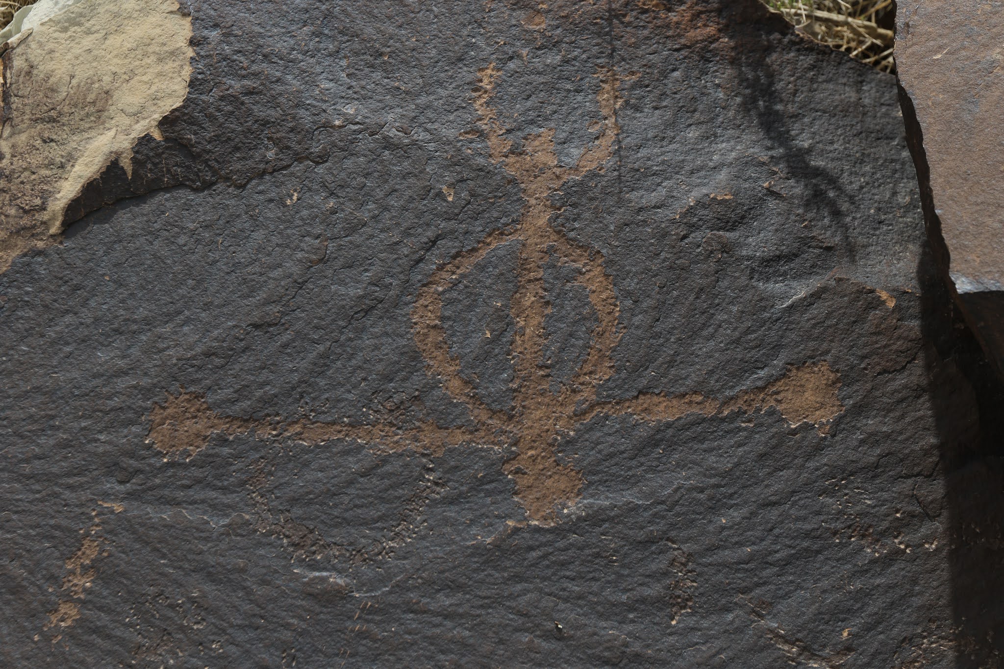
Most of the petroglyphs are very well preserved.

Interesting.

There are quite a few sandal tracks similar to those around Ferron Box.

This one that looks just like a 'Chinese Dragon' was one of our favorites.

The highest ruin on the hill looks a little like an above ground kiva or ceremonial circle.

The ruins that are lower on the hill look more like dwellings.

