Round Trip Distance: 3.6 miles
Difficulty: Easy
Elevation: 5610 - 5918 feet
Cellphone: 0 bars
Time: 2 hrs. 30 mins.
Trailhead: UT-12 MM 76.3
Fee: none
Attractions: pictographs
The Many Hands Pictograph site is located north of Escalante, Utah in the Grand Staircase-Escalante National Monument. The site is in a shallow alcove that overlooks the canyon corridor of the Escalante River a short distance away and has several panels of pictographs with various styles of hands as well as a few other images. Some might know the site by the name Pictograph Point. With the aid of a short section of 4wd road and a nice trail the site is relatively easy to access.
To get to the unmarked trailhead from Escalante head north on UT-12 for about 17 miles. As the highway climbs away from the Lower Calf Creek trailhead it passes mile marker 76. A little more than a quarter mile past the mile marker, and before reaching the top of the hill, pull off of the east side of the highway and park anywhere on the uneven slickrock. There is room to maneuver a horse or ATV trailer if there aren't a lot of other vehicles in the way.
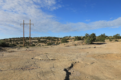
From the trailhead there is a 4wd road that passes through a green gate and takes off in the direction of the power lines. Off in the distance there is a prominent white knob of Navajo sandstone. Some maps label the peak as Pictograph Point. The Many Hands site is a few hundred yards around the corner of the knob in a small south facing alcove.
Suitable OHVs might choose to drive the 4wd road and cut 1.6 miles off of the round trip distance. The hiking is pretty easy though if you don't mind the exercise.
As you near the end of the road there is another road that branches off on the right. A little past that there is an old bridge. This is where you really want to pay attention to make the hike a little easier.
Right after passing the bridge look for a well established trail that slants off of the ridge on the right. We missed the start of the trail on our visit so we added a couple more cairns to make it more noticeable. Taking this trail makes the hiking much easier and with everyone following the same route there will be fewer confusing alternate trails.
The trail leads down to a shallow wash at the base of the knob and then begins traversing around to the south facing side making use of some of the slickrock in places before hitting the dirt once again.
A few hundred yards around the corner you can look up and probably see the pictographs. The shortest route from here is to find a spot where the slickrock isn't too steep to scramble up. We wanted to checkout the rest of the cliff so we kept going on past the site and then worked our way back along the base of the more vertical sandstone cliff that is on the same level as the pictographs. We didn't spot anything interesting to make the extra hiking worthwhile.
Some of the hands are in pairs with a left hand and a right hand and some are yellow while others are red.
There are even a few that are darker and look purplish in color.
While some of the hand images might be actual prints there are a lot of them that look like they were painted with lines that look like fingerprints but in the shape of a hand. There is even at least one where the palm is hollow with concentric circles in the middle.
Before these images were made the sandstone was smoothed to create a circle. The smoothed area has a black circle around it. There is also a concentric circle in the middle of the smoothed surface that can barely be seen. Fragments of a few other black wet charcoal type marks in other places on the cliff are mostly too weathered to make out.
There is a lot of other stuff in the area that looks like it would be fun to explore one of these days when the temperature is more moderate than it was on our visit. There is no water at all so if you bring a dog you will need to provide for it as well as for yourself. The Many Hands Pictographs are well worth taking the time to visit. There are enough images to look at that haven't faded beyond recognition and visiting the site will give you a little more of a feel for the areas earlier inhabitants. It's also a nice option for when you are waiting to find a parking place at the Lower Calf Creek Falls trailhead. If you would like to see it for yourself then all you have to do is 'Take a hike'.


