


Round Trip Distance: 8 - 10.6 miles
Difficulty: Moderate
Skill level:
Elevation: 4278 - 4556 feet
Cellphone: 1-4 bars
Time: 2 hrs. 15 mins.
Trailhead: Moab Brands or Midway
Fee: none
Attractions: Scenic trail
The Zephyr trail is located north of Moab, Utah where it connects the Moab Brands and Klonzo Mountain Biking Areas. The trail itself is 4 miles one-way with 3.2 miles of the trail following a jeep road and the other 0.8 miles being a singletrack mountain biking route. At the Moab Brands end of the trail it begins off of the Brand M Loop and at the Klonzo end it connects to the Midway trail near Big Joe Bend. The road portion of the Zephyr trail is very easy to ride and the singletrack falls more into the intermediate skill level.

For this post we began at the Moab Brands end of the trail and rode up to the Klonzo area and back. The most direct route to the start of the Zephyr trail is to take the Chuckwagon trail from the northwest corner of the Moab Brands parking area. Follow the Chuckwagon trail to the Bar M Chuckwagon turnoff and continue north from there along the pipeline road. Stay on the pipeline road to the start of the Zephyr trail. The road will be crossed by the North 40 trail and then joined by the Bar M Loop which shares its route up to the Zephyr trail.

The trail starts out by crossing the Seven Mile Canyon wash where shifting sand and piles of debris can require navigating around.

The route becomes pretty easy after crossing the wash. There are a couple of minor ledges to bounce over but the road soon becomes smooth sailing.

Just past the half mile point of the trail the road forks. Watch for a sign that directs mountain bike riders to take the right fork. Another fork with a similar sign comes up at the 1.22 mile point.

Just past the 1.5 mile point the road crosses into Arches National Park.
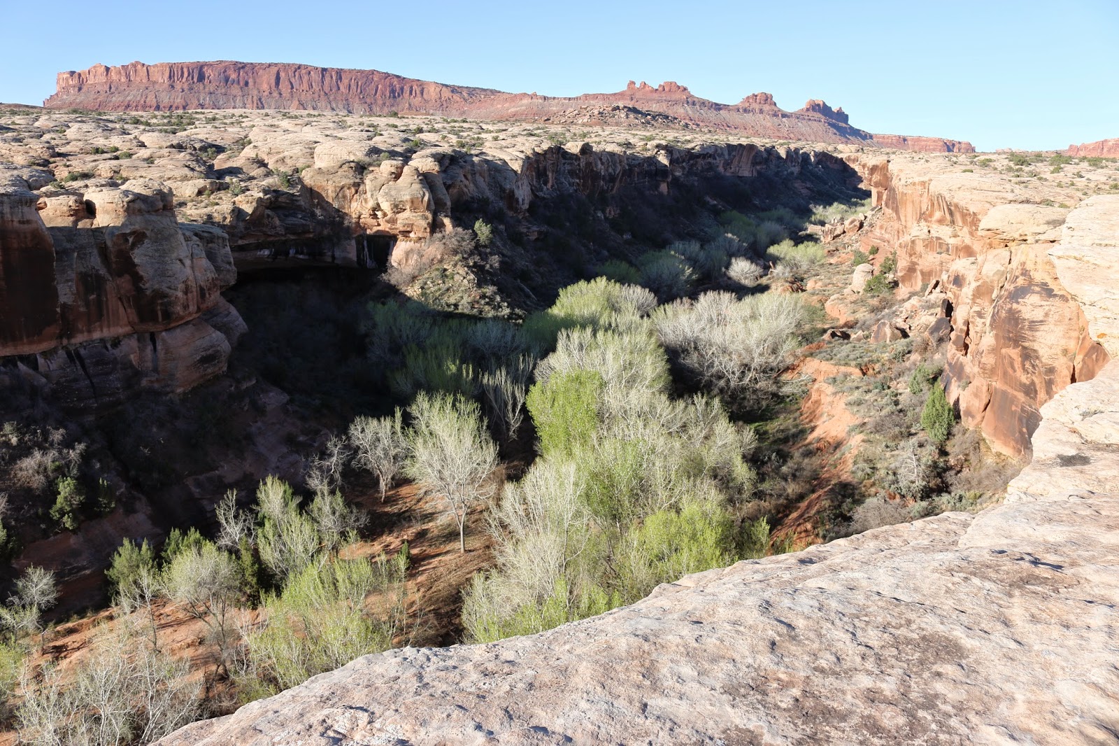
After going through the gate you can walk about 100 yards across the slickrock to the edge of Seven Mile Canyon and enjoy the views. This is the same canyon that passes through the heart of Arches National Park near Courthouse Rock. There the canyon becomes known as Courthouse Wash.

The road continues through Arches and passes through an area that is scattered with chert. Since this is within the national parks boundaries rock collecting is prohibited. It is okay to pick up samples and look at them but you can't take them with you. No worries though because along many of the trails north of Moab chert and agate are almost as common as dirt.

The trail joins another road at the 2.25 mile point and just past the 3 mile point it leaves Arches National Park and enters a branch of Courthouse Wash.

The sandy bottom of the wash can be difficult to ride through in spots but as soon as it gets around the corner the singletrack portion of the Zephyr trail begins. Up to this point the route has been open to all forms of travel including jeeps, ATVs and side-by-sides. Those vehicles can continue following the wash out to either the Copper Ridge Safari Route or the Willow Springs Road.

The first couple hundred yards of the singletrack is no picnic either. The sand is very loose as it climbs out of the wash. Once the trail crosses the wooden bridge it firms up considerably though.

The singletrack meanders toward the Klonzo end of the trail and at the 3.87 mile point it dumps out onto the Safari Road.

After following the Safari Road a short distance the single track begins again where it climbs a small hill below Big Joe Bend and comes to an end at the Midway trail. From here there are over 20 more trails in the Klonzo Mountain Biking Area that a person can choose from. For us this was the turn around point. Counting the distance to and from the Moab Brands trailhead to the Zephyr trail the total distance came out to 10.6 miles. We make mention of that just to point out how a 4 mile trail can end up turning into a much longer ride. There is a lot of great scenery on the Zephyr trail that is well worth checking out. If you would like to see it for yourself then all you have to do is grab your bike or 'Take a hike'.