


Round Trip Distance: 6.6 miles
Difficulty: Moderate
Skill level:
Elevation: 6044 - 6484 feet
Cellphone: 1-5 bars
Time: 3 hrs.
Trailhead: Sunset Rocks
Fee: none
Attractions: Scenic geology
The Sunset Rocks trail is located in the Gunnison Gorge National Conservation Area and Wilderness east of Olathe, Colorado. The Gunnison Gorge NCA protects a swath of land along both sides of the Gunnison River from the Black Canyons of the Gunnison National Park northward to Highway 92. Trails in the area are set aside for hiking, biking, horseback riding, dirt bikes and jeeps and other OHV on designated routes.

The 'get directions' function for Google Maps will get you within a couple miles of the trailhead but that is about it. The best route is to turn north 1 mile south of Olathe on the paved Falcon Road and follow it for about 3.7 miles and continue straight on the now gravel Peach Valley Road. At the staging area and campground take the Chuckar Road the last couple of miles to the Sunset Rocks trailhead. You will pass a wilderness area fee information station along the road but it is only necessary to pay the fee if you are going into the wilderness area which is way beyond Sunset Rocks.

The first part of the Sunset Rocks trail is a loop. For this post we will head east from the trailhead along an old jeep road.

The color of the rocks in this area are what gives the trail its name.

As the trail climbs the mountain east of the trailhead it passes one interesting geological area where the rocks are tilted 90 degrees and suddenly the different layers are facing straight up.

After hiking just over a quarter mile you have the option to take a short side trail that leads over to a tunnel type cave.

The cave passes all the way through the hillside and has an opening in the roof that serves as a skylight. Actually it looks like it also served as a smokestack judging from all of the soot around it. The cave appears to have been used as a shelter at least off and on over long periods of time.

After leaving the cave and getting back on the main route the trail continues looping around the mountain side until the loop closes and it reconnects with itself. This intersection is 1 mile from the trailhead the way we came and a half mile back to the trailhead if you were to turn left at this point. That makes hiking the loop by itself 1.5 miles. At this point we follow the trail to the right.

The trail climbs as it heads off to the north winding in and out and up and down around hills and washes.

The high point of the trail is right at 2 miles from the trailhead the way we came. The last quarter mile of the trail getting to this point is the steepest.

For the next 1.3 miles the trail travels around the mountains falling and rising in elevation as it goes with a few stretches that are almost level.

The turnaround point for this hike is at the junction of the Sunset Rocks and Eagle Valley trail. This section of both trails also server as part of the longer Sidewinder trail. The elevation at the turnaround point is 6080 feet which is 400 feet lower than the high point and the high point is 400 feet higher than the trailhead. But alas there is about another 400 feet of elevation change along the way which puts the overall change over 1200 feet.
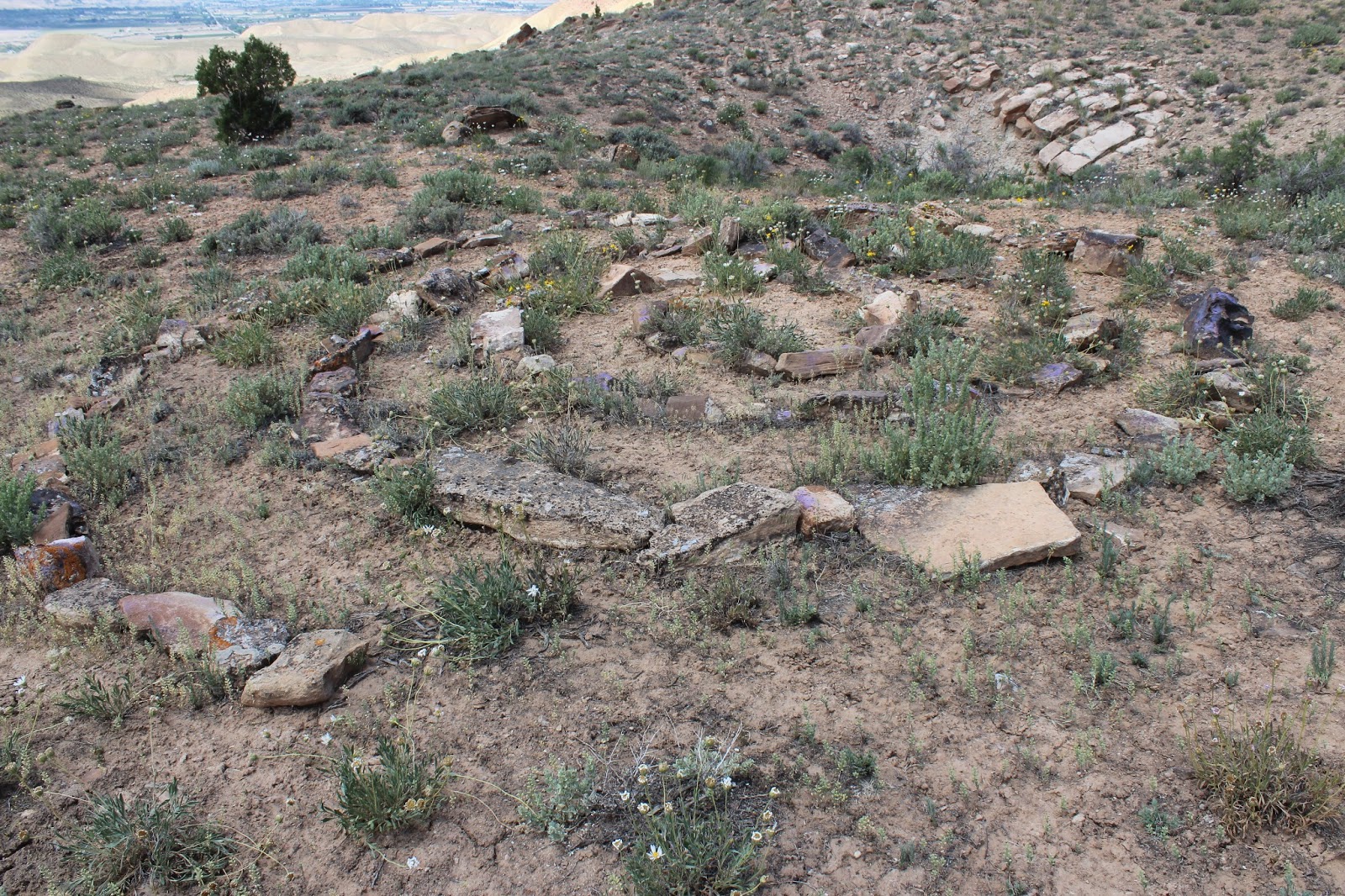
On the way back as you near the trailhead there is a spiral made of rocks. Judging from the growth around the spiral it has been there for quite some time. Just another one of those things to wonder about.

