Round Trip Distance: 0.3 miles
Difficulty: Easy
Elevation: 3983 - 4000 feet
Cellphone: 0-3 bars
Time: 1 hr. 30 mins.
Trailhead: Squaw Creek Group
Fee: none
Attractions: petroglyphs
The Squaw Creek North Petroglyphs are located in the Tonto National Forest, bordering on the Agua Fria National Monument, northeast of Black Canyon City, Arizona. Scores of petroglyphs are found all along the base of the cliffs below the rim of the mesa. The North Petroglyphs are those that are directly below the Main Pueblo. Another large group of petroglyphs are along the same cliffs to the south of the pueblo.
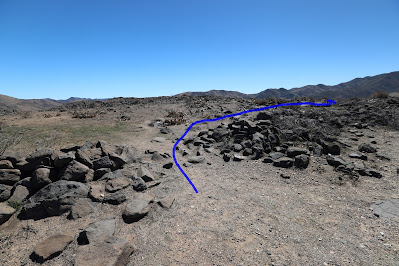
After finding your way to the main pueblo enter the enclosure and follow the inside of the wall around to the rim on the right side of the pueblo. A person could also hike around in the opposite direction to the left side of the pueblo and get below the rim going that way.
An obvious trail leads over the side of the rim where it splits with one branch heading north below the pueblo and the other branch heading south along the base of the cliffs in that direction.
No sooner do you get started than you begin seeing petroglyphs. Some of them are high up near the walls of the pueblo.
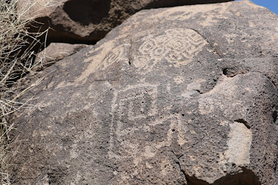
Most of the first petroglyphs are sheep and deer but there begin also to be some geometric images like this one that reminds you of a domino.
Concentric circles and a sheep with forward pointing horns. Maybe a watering hole right in front of the sheep and then some object under a rainbow.
This interesting panel has an outlined cross that is sometimes called the Venus symbol. To the right of that is the 'crossed path' or 'paths crossing' symbol. Here it has a line above it but I don't really see what meaning to draw from it in this context. In the upper left are what look like a couple of masks or skulls.
Three circles with short tails, a couple of snakes, maybe a centipede, and a few other images.
A turtle, snake, sheep, and concentric circles.
It's hard to get around some of the boulders to take good photos. There is a lot of scrambling and climbing around.
Spirals, mazes, and sheep.
We weren't paying much attention to the camera for some reason and took a lot of photos that didn't turn out very well.
We'll leave off here just saying that there are a lot more petroglyphs to see. We culled about 100 photos from the slideshow because it was getting too long. If we decide to go back and get better pictures we will probably drop below the rim on the north side of the pueblo and work our way south from there saving a little backtracking. If you would like to see it for yourself then all you have to do is 'Take a hike'.


