

Round Trip Distance: 0.8 miles
Difficulty: Easy
Elevation: 3314 - 3463 feet
Cellphone: 0 bars
Time: 1 hr.
Trailhead: Gunlock Rd. MM 3
Fee: none
Attractions: petroglyphs, pithouses
The Gunlock 3 Mile Site sits on a bench along the Gunlock Road, at mile marker 3, overlooking the Santa Clara River between St. George and Gunlock, Utah. The site, which is relatively easy to access, includes several faint depressions that probably were former pithouses and, best of all, dozens of well preserved petroglyphs that are scattered around on numerous basalt boulders.

To get there from St. George head to Santa Clara and continue north on Old Highway 91. About 7 or 8 miles past Santa Clara, depending on where you began measuring, take a slight right onto the Gunlock Road and zero your odometer. When we were last there mile marker 3 was missing but the safest place to park is across the road where there is a pullout near a turnoff. For those pulling a trailer this side road is a good place to park or turn around. You can get turn by turn directions by entering Gunlock, Utah into your driving app and when it shows that you have 5 miles remaining you should be at this spot since it is 5 miles south of Gunlock.

After crossing to the east side of the highway and heading back toward mile marker 3 there will be an old 4wd road that starts climbing above a wash. As you head up the old road you will probably start noticing where others left the road on the right and began scrambling around the shoulder of the hill. That will take you almost directly to some of the boulders with the most petroglyphs that are perched right on the side of the bench above the highway. It is quite a bit easier though if you just stay on the old 4wd road until you get up around the powerlines where it is much easier to hike back around onto the bench.

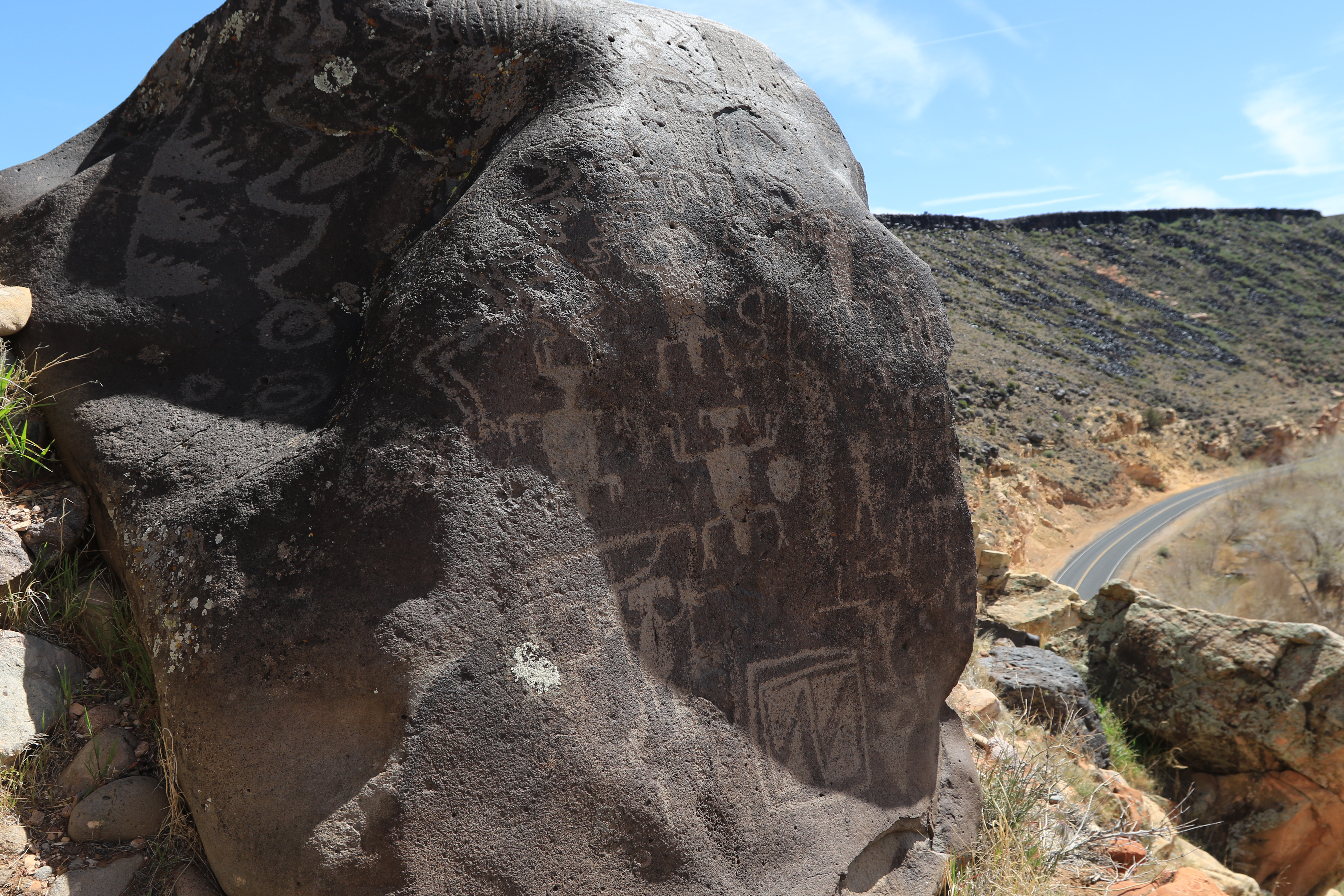
The largest boulder with the most images sits right on the edge of the bench. It is quite fortunate that it wasn't dislodged when the highway was built. It is close enough to the edge that we didn't feel comfortable walking around the side the drop off is on.
These are a few of the images on the west side of the boulder.

We are given to understand that often times cranes represent the 'bringing of winter snow and rain' according to Carol Patterson's Basket Maker study. This is a particularly nice image, as can be seen, that is on a nearby boulder.

The large boulder is covered with images on all sides.

The map that accompanies this post has 5 black dots that mark the location of boulders with petroglyphs but those are just a few of the main boulders. As you walk around the bench you will find many more.

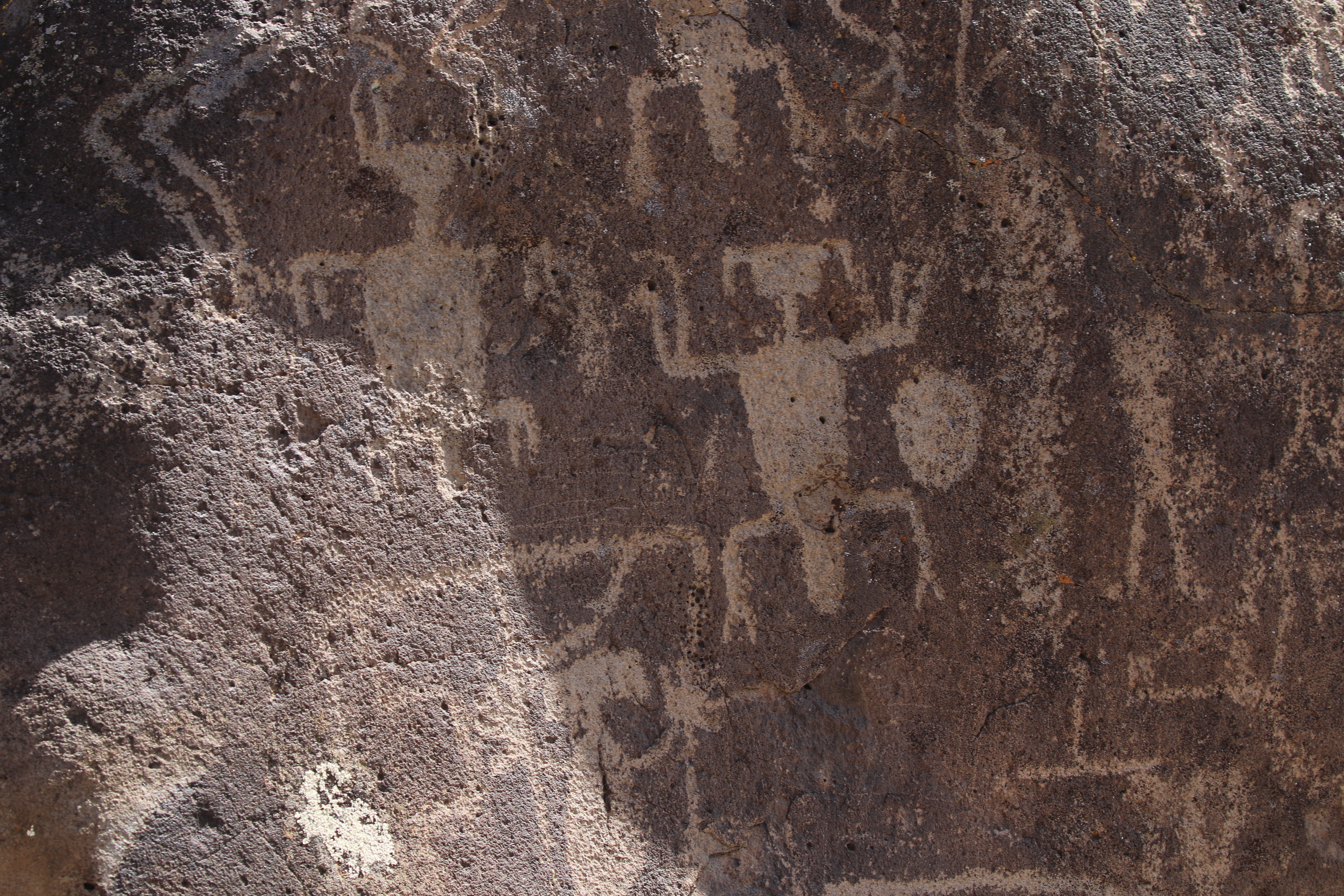
This is a real puzzler but it might represent a person that is upside down. The hands and feet with their fingers and toes are sticking up while the encircled head is facing down. The fact that it is downward facing usually signifies death.

Sometimes natural features in the rocks were meant to be incorporated into the image. It might be that 2 of the toes of the left foot are represented by dimples in the boulder.

What look like former pithouses are a couple of depressions in the ground. This one has a ring of rocks around its circumference. Remember that it is illegal to dig or excavate around archeological sites not to mention doing anything that causes damage which can be as simple as touching the petroglyphs.

