


Round Trip Distance: 6-10 miles
Difficulty: Strenuous
Elevation: 5752 - 6160 feet
Cellphone: 0-2 bars
Time: 3-5 hrs.
Trailhead: Cactus Park
Fee: none
Attractions: Wilderness area
The Triangle Mesa trail is located in the Dominguez Canyon Wilderness Area near Grand Junction, Colorado. The trail begins off of the Dominguez Canyon Overlook trail where it travels east across the saddle of a ridge with Dominguez Canyon on one side and another unnamed canyon on the other side. After crossing the saddle the trail makes a loop around Triangle Mesa before returning to where it began. Scenic views of both canyons coupled with the solitude of a seldom used route provide the setting for this wilderness experience.

To get to the trailhead which is located in Cactus Park follow the directions for the Dominguez Canyon Overlook trail.

The Triangle Mesa trail begins near the 2 mile point of the Dominguez Canyon Overlook.

The trail follows an old jeep road that was closed for restoration before the area became a wilderness area. We checked with the BLM office to confirm that it was still okay to hike the route.

From where it begins the trail heads towards a hill which it travels around on the north side, passing around a manmade barrier that was put there to block vehicle access. Shortly after that the trail splits. The right fork leads up the hill and eventually reaches a dead end after a quarter mile or so.

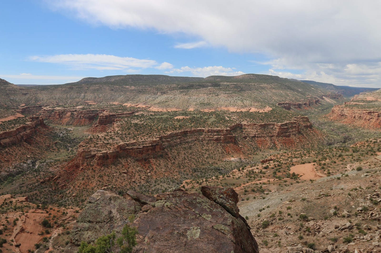
As the trail along the left fork continues it wraps around the side of the hill. Much of the remaining route over to Triangle Mesa comes into view at this point.

There is a scenic redrock canyon that forms the drainage on the north side of Triangle Mesa that from here looks very hikeable. The canyon beckons to be explored so all its secrets can be revealed to anyone willing to pay the price of admission consisting of the requisite effort that it demands.

The trail descends to its lowest point as it crosses the wide ridge between the two canyons and then begins climbing in earnest.

The trail continues gaining elevation when near the 1.5 mile point it reaches the point where the loop begins. Our GPS was showing 2.22 miles but that included about 3/4 of a mile that was spent exploring the side trail at the first fork that we came to.

The trail around the mesa levels off and becomes pretty easy to hike. At one point you can spot Tunnel Point on the opposite side of the Gunnison River. Glimpses of the Bridgeport Road can be seen but the trailhead itself is more elusive.
The real treat comes as the trail bends around to the south side of the mesa where Dominguez Canyon is laid out below.

Portions of the trail can be seen as well as the waterfalls that come up just before the first petroglyphs. Looking in the direction of the upper canyon you can see almost as far as the Dominguez Campground.

