


Round Trip Distance: 6.4 miles
Difficulty: Moderate
Elevation: 5411 - 5651 feet
Cellphone: 0-3 bars
Time: 2 hrs. 15 mins.
Trailhead: Lower Sand Canyon
Fee: none
Attractions: Scenic loop
The Rock Creek trail is located in the Canyons of the Ancients National Monument west of Cortez, Colorado. The trail makes a four mile loop around a bench in Rock Creek Canyon. The trail was created with mountain bikers in mind with manageable transition points where needed. While the Rock Creek trail by itself is only 4 miles in total length a connector trail is required to get there from the trailhead. The shortest route is 1 mile one-way and is only open to hikers and horseback riders. The next option is a 1.2 mile route that crosses a lot of slickrock. It is only open to hikers and mountain bikers. This post takes the 1st option that is closed to mountain bikes for the trip over to the Rock Creek trail and returns via the 2nd route. Even though we are only showing one route on our map the other route is shown on one of the photos below.

The Lower Sand Canyon trailhead is located 12 miles west of Cortez on County Road G. The current parking area is a very rough section of slickrock. In the near future the trailhead will be moved to some newly purchased land a little further to the east.

The lower trail, which is not open to mountain bikes, departs on the left along the boundary between the monument and private property.
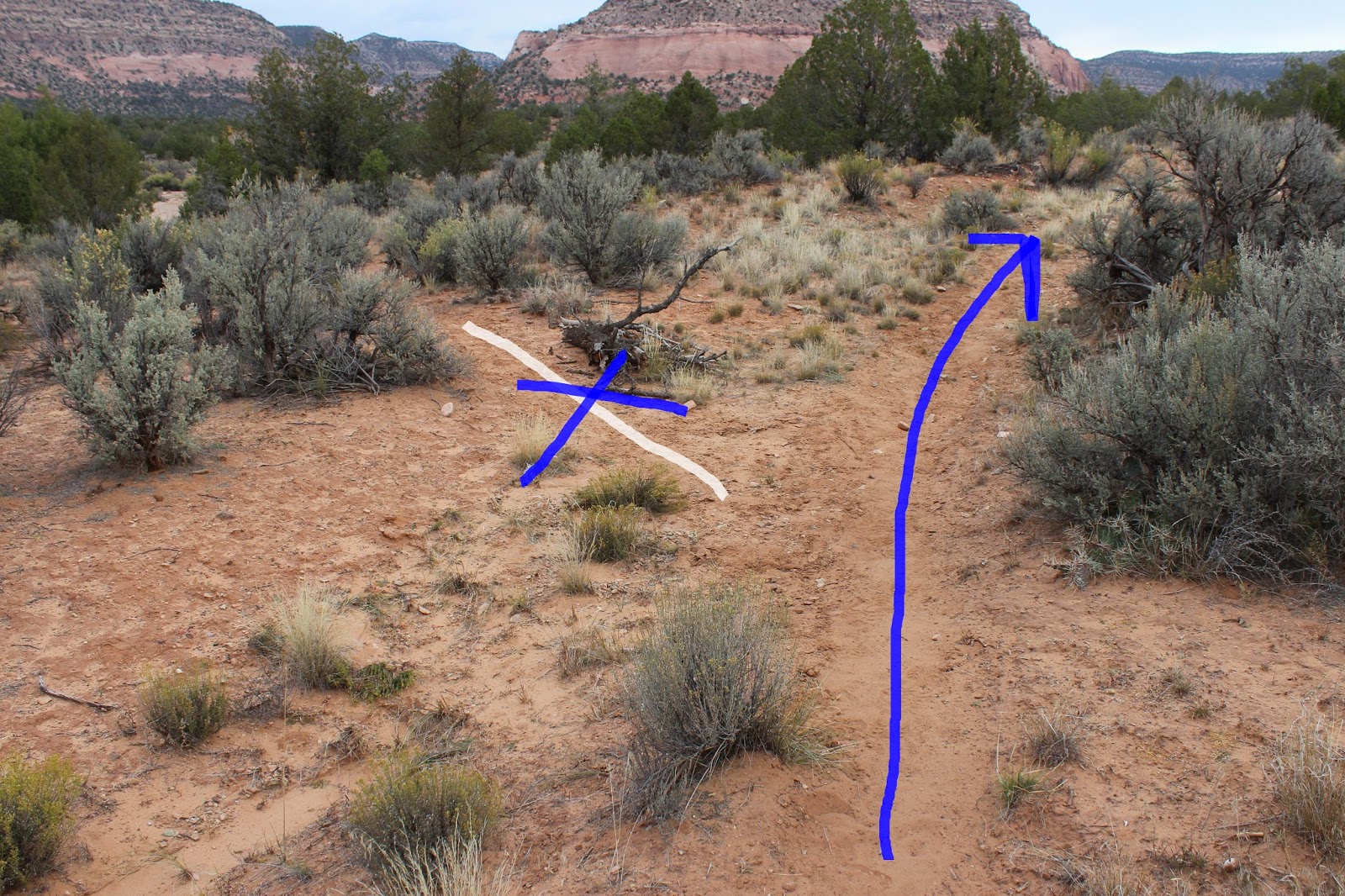
The trail borders private property as it heads west until it gets near the lower wash of Rock Creek. At the one mile point a trail branches off on the left and enters the wash. That branch of the trail is an unofficial spur that has a lot of loose sand and is much more difficult to hike. Even though it looks like a shortcut don't be fooled.

Within a quarter mile from that fork is another junction that is marked with a sign. At this point the slickrock route connects with the main trail. About 50 feet or so further up the main trail there is a split where we follow the left fork off of the hill to the next junction. This part of the trail has the green markers of the East Rock Creek trail.

The next junction is the official start of the Rock Creek trail where it departs on the left. The Rock Creek trail is signed with yellow markers.

After the trail crosses the normally dry wash of Rock Creek it travels up the west side of the canyon. There are several places where the trail climbs in and out of side washes but they don't add much to the overall difficulty of the hike.
At the 3.5 mile point of the hike, measuring from the trailhead, the trail crosses Rock Creek and begins looping back out of the canyon along its east side.

The east side of the canyon has a couple of spots that are a little more technical for mountain bikers. The slideshow at the end of this post should have enough pictures to give a good idea of what the trail is like. The hike back out of the canyon trends in the downhill direction and is pretty easy to hike.

Right around the 5.4 mile point the Rock Creek trail rejoins the East Rock Creek trail.

Back at the first signed trail junction that we passed on the hike in there is the option to either return to the trailhead along the original route or take the left fork and tackle the slickrock route. The original route is shorter and a whole lot easier but the slickrock route is much more interesting.

It might not be apparent from this photo but the slickrock where we are parked is very uneven and requires a vehicle with a little bit of clearance to manage it. The area closer to the road is more suitable for passenger cars although there is only room for a few depending on how everyone else is parked. Of course once the trailhead is relocated none of that will matter anymore. The Rock Creek trail is nice for anyone that happens to be in the area looking for a good hike where you won't run into a lot of people like you might on the Sand Canyon trail. Most of that is because it lacks any cliff dwellings or pueblos. It is still a good hike though and probably a fun mountain bike ride also. If you would like to see it for yourself then all you have to do is 'Take a hike'.